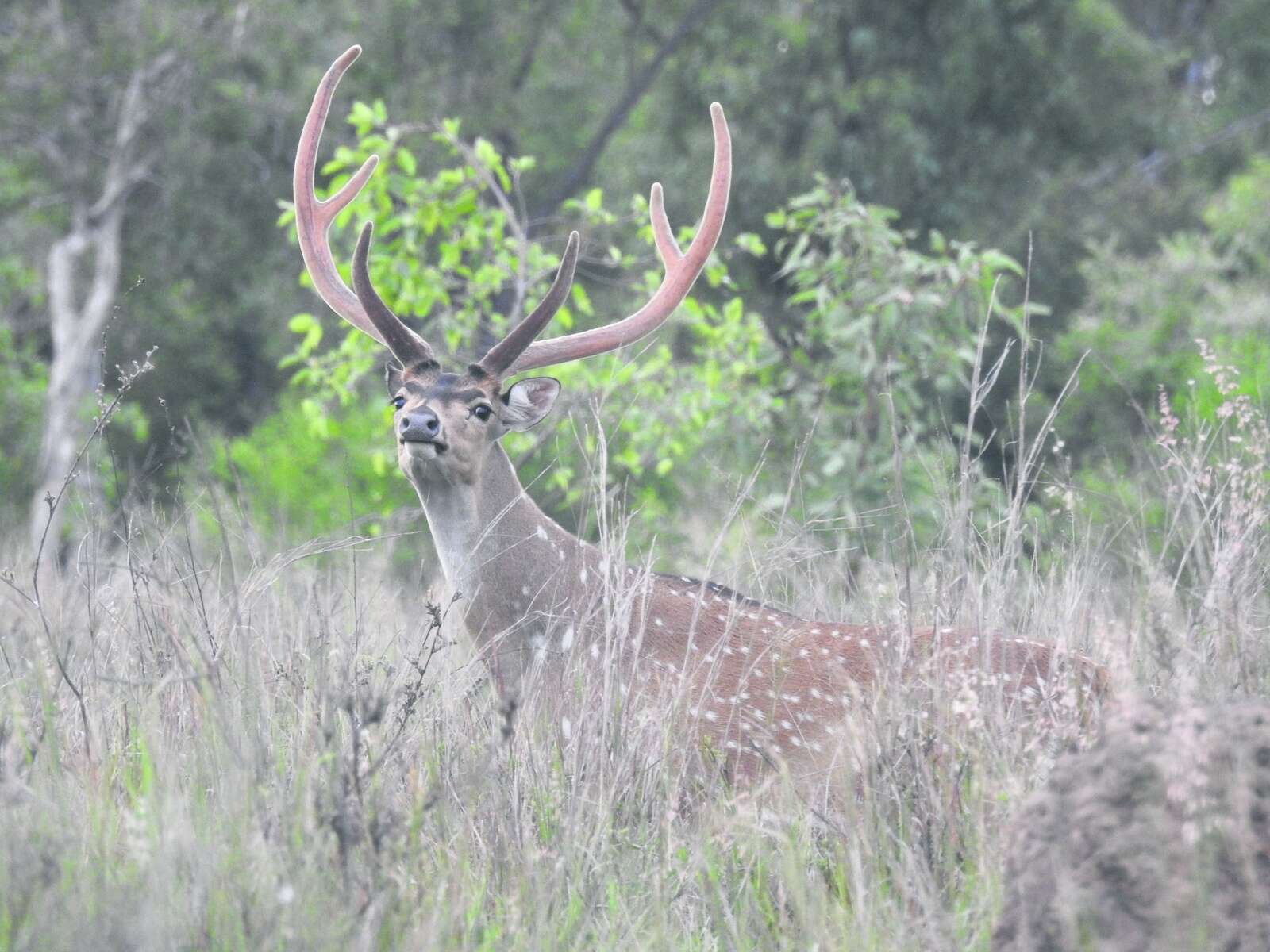
Chital deer occupy a special place in the Australian deer landscape. Their graceful movement, distinctive spotted coats and social behaviours make them a species that many hunters and land managers respect and enjoy observing. At the same time, their rapid expansion through northern Queensland has created a need for knowledge about how they use the landscape and what shapes their distribution.
A recent scientific investigation has offered a deeper understanding of these patterns. The study explored both fine-scale and broad-scale factors that influence where chital are found, why they favour certain areas and how environmental features can guide their future spread. Although the research has clear management applications, it also provides valuable insights for anyone interested in wild chital in the Australian environment.
This article outlines what the researchers set out to discover, their approach, and what their results indicate about the ecology of this distinctive deer species.
Why Study Habitat Use in Chital?
Chital were brought to Queensland in the late nineteenth century. For decades they remained relatively localised, but that situation has changed. In recent years, the population has grown noticeably and expanded into new regions. With this has come increased interest among graziers, hunters and ecological researchers in understanding the factors that shape where chital go and how they live in northern Australian landscapes.
In their native range across the Indian subcontinent, chital are widely recognised as a species that responds strongly to food quality, water availability and the presence of predators. They graze on a range of grasses and forbs and shift between open feeding country and thicker cover to balance food needs with safety. In Australia, there are fewer predators, yet the landscape challenges are more extreme, with marked seasonal differences and highly variable soils.
An important theme in ungulate ecology is that soil mineral content can shape foraging choices. Phosphorus and sodium, in particular, are central to bone development, antler growth, reproduction and overall health. These minerals influence not only the chemistry of plants but also the nutritional pathways animals rely on. Since Australian soils in the dry tropics are some of the most nutrient limited on the continent, the question of how deer respond to these conditions is especially relevant.
The investigators wanted to examine these relationships at two scales. First, they examined a large pastoral property to assess how chital position themselves in that landscape. Second, they broadened the view by surveying landholders across the region to understand distribution patterns at a larger scale. By pairing the two approaches, they could see whether the same drivers were important across different scales of space.
How the Local Scale Research Was Conducted
The fine-scale work took place on a substantial cattle property in the Charters Towers district. This country is typical of dry tropical rangelands, characterised by a mixture of native and introduced grasses, scattered eucalypt species, and three distinctive seasons. Water is supplied through troughs and dams, and the Burdekin River provides a reliable source along one boundary.
Researchers deployed a large camera grid across the property. They began by creating a network of evenly spaced points and then selecting locations that were near access tracks to ensure that cameras could be serviced. Over a little more than a year the cameras collected many thousands of images that allowed the team to document chital presence and behaviour.
Whenever a new sequence of chital photos was separated from the previous sequence by at least an hour, it was considered a separate ‘sighting’ event. This method helped standardise the data and improve the reliability of comparisons across sites.
The team also used spatial data to understand environmental characteristics around each camera. They measured distance from water sources, homesteads, highways and tracks. They assessed vegetation greenness using satellite-based vegetation indices and calculated canopy height and foliage cover. Most importantly, they extracted predicted soil mineral content values for phosphorus, sodium and the balance between calcium and magnesium using high-resolution soil mapping.
These variables were then used to develop statistical models to identify the features that best predicted chital activity across the property.
What the Local Scale Study Revealed
The most striking observation was the connection between chital activity and predicted soil phosphorus. Areas with higher phosphorus levels had noticeably more deer events. This result supports what many wildlife ecologists have seen in other herbivores around the world. Where soils are more nutrient rich, plants often contain improved mineral profiles and animals respond by spending more time in those areas.
Sodium was also positively associated with chital abundance. This connection was expected because chital are known to use natural or artificial licks in other countries where sodium is limited. In north Queensland, some pastures have higher sodium concentrations due to evaporation patterns and land clearing. This may create subtle but meaningful differences in the attractiveness of certain grasslands to deer.
Vegetation structure was another important factor. Cameras in areas with lower canopy height and reduced foliage cover recorded more chital activity. These open conditions allow deer to feed on grasses more easily and to maintain good visibility. Chital frequently alternate between open grazing and resting in thicker vegetation, so this result aligns with observations from their native range.
Interestingly, chital were more abundant close to homesteads and highways. This was counter to the expectation that deer might avoid human infrastructure. The researchers offered several explanations. Areas around homesteads often receive more consistent management, including pasture maintenance and water reliability. The land near highways can include broader open corridors with high grass biomass. It is also possible that these human-influenced areas offer some protection from dingoes if the predators avoid close contact with humans. Whatever the cause, the pattern was clear and repeated across the property.
Distance to water, on the other hand, did not emerge as a strong predictor in this particular part of the study. The researchers noted that the property has a dense network of artificial water points for cattle, and that many of the cameras operated mainly in the wetter periods of the year. This may have reduced the influence of water availability on chital behaviour during the study window.
Overall, the local scale work provided valuable detail about how chital respond to the fine structure of the environment. Soil nutrients, vegetation openness, and proximity to human features all shaped how deer used the landscape.
How the Regional Scale Work Was Conducted
To complement the camera work, the team collected data from across the district through a landholder survey. The regional council distributed surveys to property owners and managers asking them to estimate the number of chital on their land. These estimates were provided either as exact numbers or ranges. The researchers then converted these figures into conservative density estimates by using the lower bound of each range.
In total, nearly 100 surveys were returned, and just over half reported the presence of chital. The researchers created spatial layers for each property, calculating predicted soil nutrient concentrations, distance to major watercourses, long-term vegetation greenness and the average slope of the land. These layers were extracted using the same state-based environmental datasets used in the local study.
This generated a broad picture of chital distribution across the region. Statistical models were then built to explore which variables best explained the reported densities.
What the Regional Scale Study Revealed
The most consistent pattern at the regional level mirrored that of the local study. Chital density increased with predicted soil phosphorus. Even when the models included several other variables, phosphorus remained the strongest and most reliable predictor of where deer were more abundant.
Other variables such as sodium, slope, vegetation greenness and distance to rivers appeared in some of the top models but with wide variability. Their influence was not strong enough to draw firm conclusions. The repeated significance of phosphorus across both scales, however, suggests that this mineral plays a central role in the ecology of chital in northern Queensland.
The soil landscape of this region helps explain the pattern. Much of the country is geologically old with long periods of weathering that have reduced phosphorus levels. Pockets of higher phosphorus stand out in this environment and these areas appear to hold more chital. The first release site of chital over a century ago was in one of these phosphorus rich pockets, which may have contributed to the early success and stability of the founding population.
By combining the landholder survey responses with environmental information, the study was able to map the historical spread of chital and identify zones where future expansion is most likely. Areas with higher predicted phosphorus appear more at risk of becoming occupied if deer continue to spread.
Understanding the Meaning of These Findings
The study's strongest overall insight is the importance of soil nutrients, particularly phosphorus, in shaping chital deer use of Australian landscapes. Phosphorus plays a role in skeletal development, antler growth and many internal metabolic processes. When soils are extremely low in phosphorus, as they are in much of northern Australia, the availability of this nutrient can become a major ecological constraint. Animals that rely on phosphorus either need to seek out plants that concentrate the mineral or move to where soils offer more of it.
This does not mean that chital consciously select soils; instead, they respond to plant communities and habitat features that reflect underlying nutrient conditions. Grasslands that grow on phosphorus-rich soils may offer better nutrition throughout the year. Such areas may also correspond with better pasture response after the first rains, improving the availability of young high-quality shoots.
The relationship with sodium, although clearer at the local scale, supports the broader theme that mineral availability affects grazing patterns. Sodium is essential for many physiological functions especially during lactation. In many parts of the world, herbivores seek out sodium licks or feed on plants that accumulate sodium. The slight increase in deer activity in areas with higher predicted sodium is consistent with this idea.
The vegetation findings add another layer to the picture. Chital appear to spend more time in open grass-dominated environments rather than dense or tall canopy areas. This is expected for a grazing species and helps explain why they are often observed in paddocks with abundant grass cover or along open corridors.
The association with homesteads and highways is a reminder that human land use can shape deer distribution. It suggests that deer may be responding to subtle habitat features created by infrastructure and land management rather than being simply drawn to human presence. More open pasture, consistent water availability and possibly lower predator risk around these areas may contribute to the pattern.
Considerations and Future Work
The researchers acknowledged important limitations. Camera data were collected mainly during wetter months, which may mask the importance of water availability. Landholder estimates can vary in accuracy. Soil nutrient maps are predictive rather than measured at each site, though they remain the best available representation of spatial nutrient variation.
Future work may involve collecting actual soil samples, using GPS tracking collars on chital to record seasonal movement and exploring genetic data to understand how rivers and other landscape features influence the spread of the population.
Why These Findings Matter for Deer Enthusiasts
For readers of this magazine, this study deepens our understanding of chital as a species. The patterns of habitat use revealed here indicate that the animal is finely tuned to its environment and responsive to the chemistry of the landscape. Chital are not simply opportunistic grazers. Their distribution reflects complex ecological factors including mineral availability, seasonal greenness, vegetation structure and subtle features of human land use.
Recognising these patterns helps hunters and wildlife observers appreciate the broader ecological story behind the animals they encounter. It shows how chital navigate challenging Australian environments and how they may continue to adapt as they expand their range.
This research reinforces the value of a detailed ecological approach to understanding wild deer in Australia. Whether for management, conservation, hunting or simple appreciation, knowledge of how deer interact with soils, plants and the wider landscape helps everyone engage more thoughtfully with this remarkable species.
Do you want to get the last Australian Deer news, events, updates & competitions directly to your inbox?
Enter your name & email below and we'll make sure you're the first to know!


